FSCSP: Logger Site Details
FSCSP: Logger Site Details |
Note: You can search for a name or topic by using a control-f (for PCs) or a command-f (for Macs) |
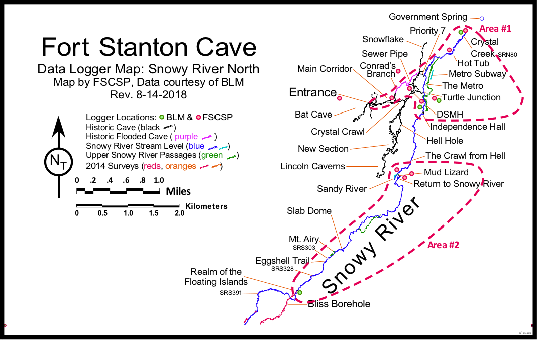
Current Locations for Baro and Water Level Data Loggers for Snowy River & Main Corridor |
||
This page lists various loggers "in order" heading south, traveling upstream from the Crystal Creek area at the north end of the cave. The FSCSP loggers are In-Situ Rugged Troll units. The BLM loggers are Solinst loggers. The "areas"are shown on maps. |
||
Area #1
|
Justification & Location Information |
|
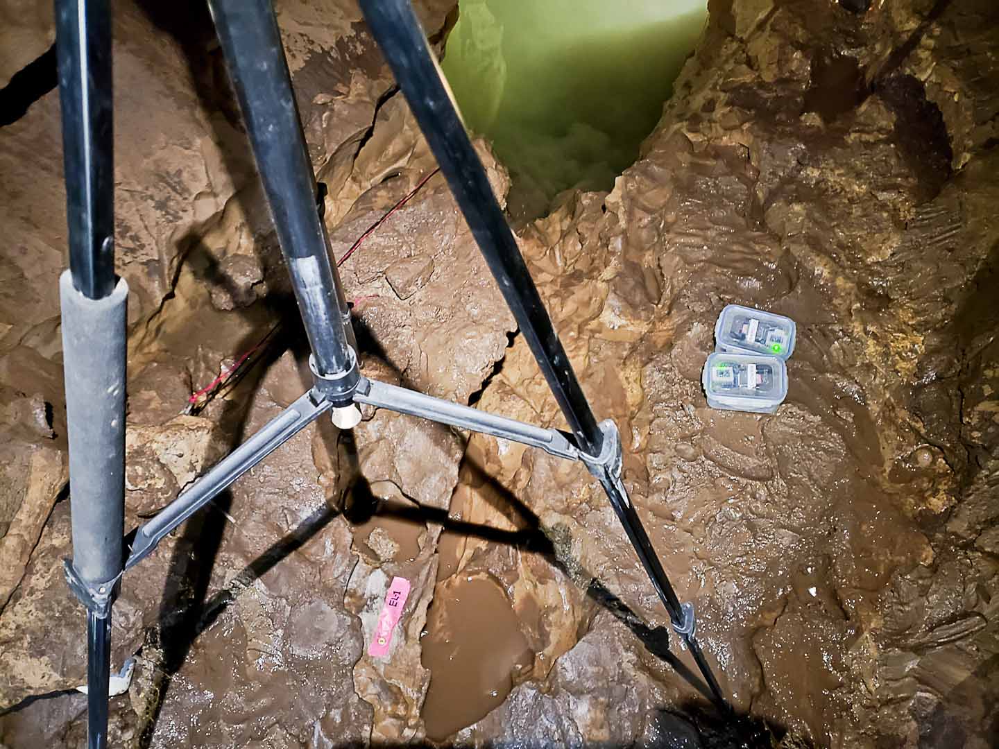
Crystal Creek SRN80NEW (Stage & temperature vs time from 2009) RT-100 and a pair of BLM Solinst loggers installed |
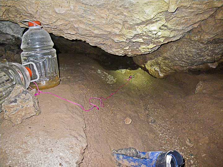
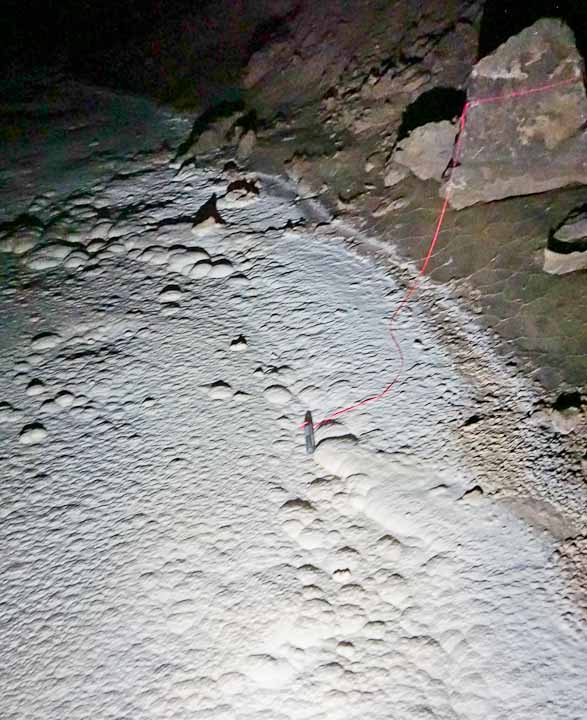
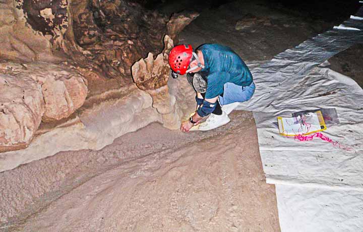
Closest site to Government Spring, which can be correlated to the volume of the surface outflow of both stream systems in the cave. W27 logger installed 10-12-19 W24 logger installed 7-12-18 W1 logger installed 4-30-13 (photo) There is also a BLM Solinst logger at this site, which can be seen in this photo, upper right. |
 |
Crystal Creek Falls (The floor of Lincoln's Bathtub, just above the logger in Crystal Lake/Crystal Spring)
SRN79.5 (Stage & temperature vs time from 2019) RT-100 |
This location is just upstream from the 3-foot fall, and measures critical flow into Crystal Lake. This location will possibly give information to better understand the small flow when Snowy River is not flowing.
W1 logger installed 10-12-19 |
 |
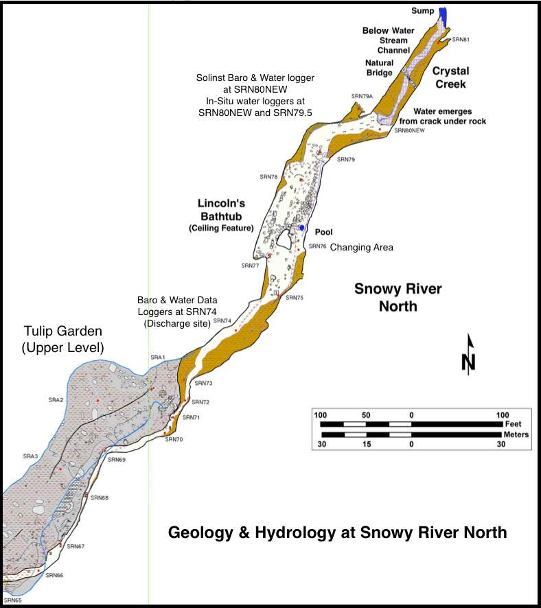
Snowy River North SRN74 (This site is optimized for flow measurements and Stage & temperature vs time from May 2021) RT-Baro & RT-100 installed for discharge measurements. |
This logger pair (baro + water depth) will provide improved water level data smoothing for the North end of the Snowy River Passage. This site was approved by hydrologists as the best location between the existing SRN53 site and Crystal Spring, which feeds Crystal Lake and ultimately Government Spring. It is located near the northern end of the Snowy River calcite where the passage floor down-cuts to the limestone. SRN74 is near the center of the map. The two upper levels shown (Tulip Garden and Lincoln's Bathtub) may be on top of an unknown source that appears to flow out of the breakdown before joining the source providing water for Crystal Spring. When Snowy River is flowing that water joins the breakdown source just north of SRN79. (Click on the map for an expanded view) |
 |
Swimming Pool (was called Hot Tub) SRN53 (Stage & temperature vs time from 2013) RT-100 |
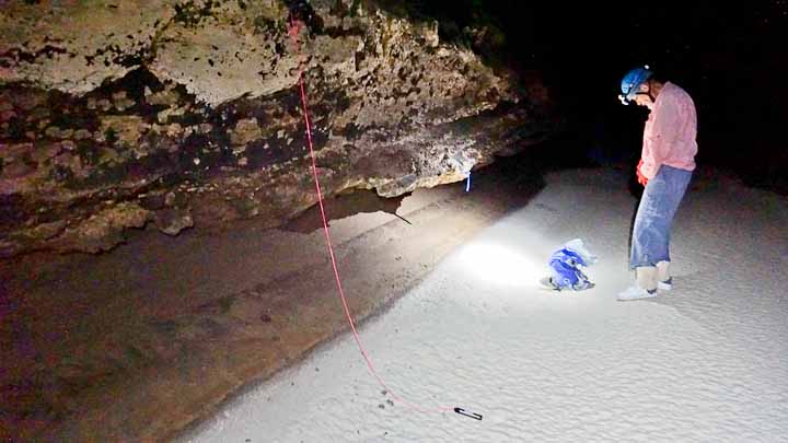
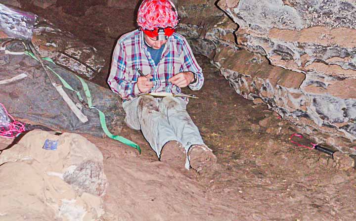
Deep pool between Turtle Junction and Crystal Spring. This large pool provides timing information on the primary Snowy river flow, and also contribute to our knowledge of the drain-down timing for Snowy River North. W18 logger installed 7-12-18 W2 logger installed 4-30-13 (photo) |
 |
Below Metro North SRN33 (Stage & temperature vs time from 2019) RT-100 |
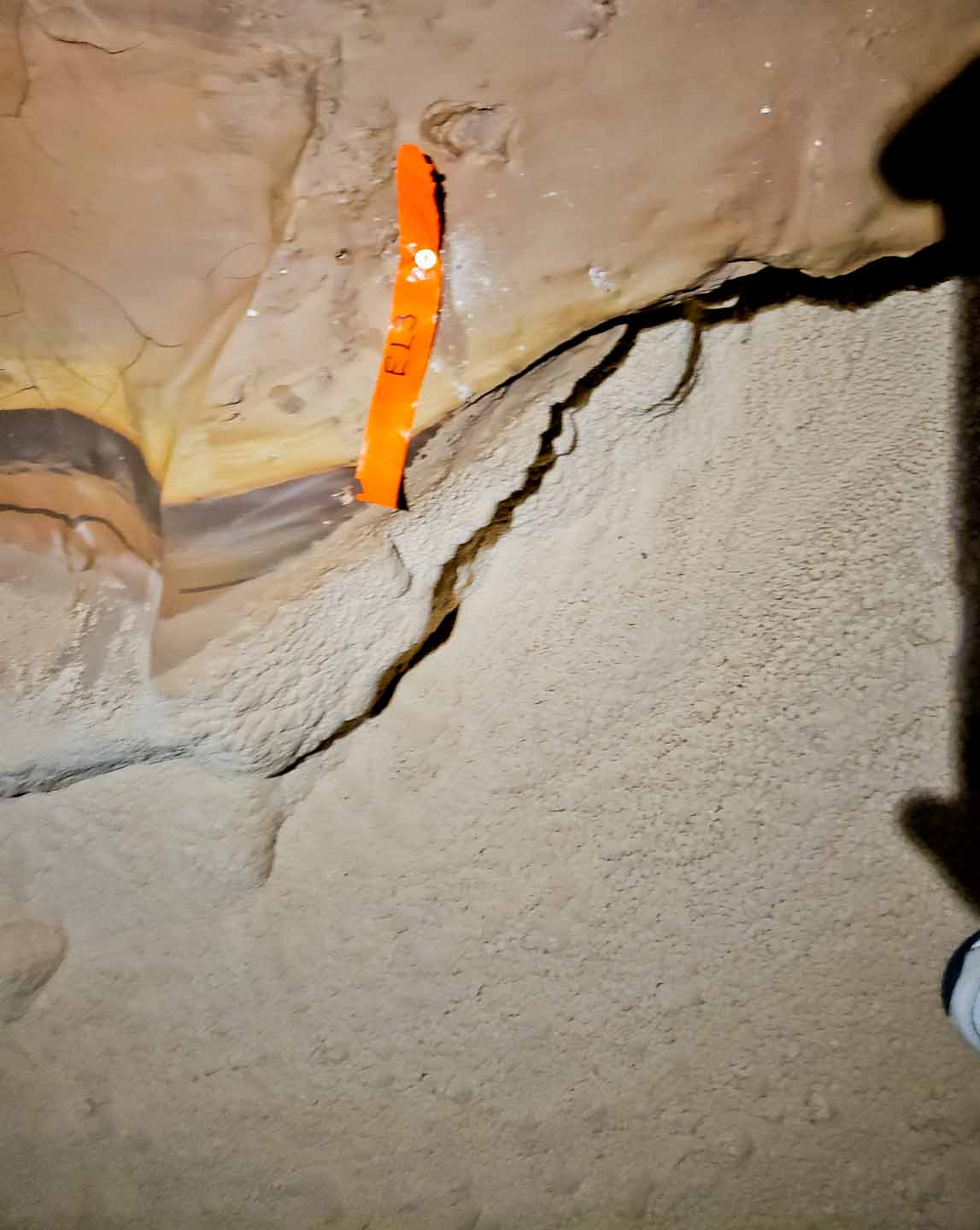
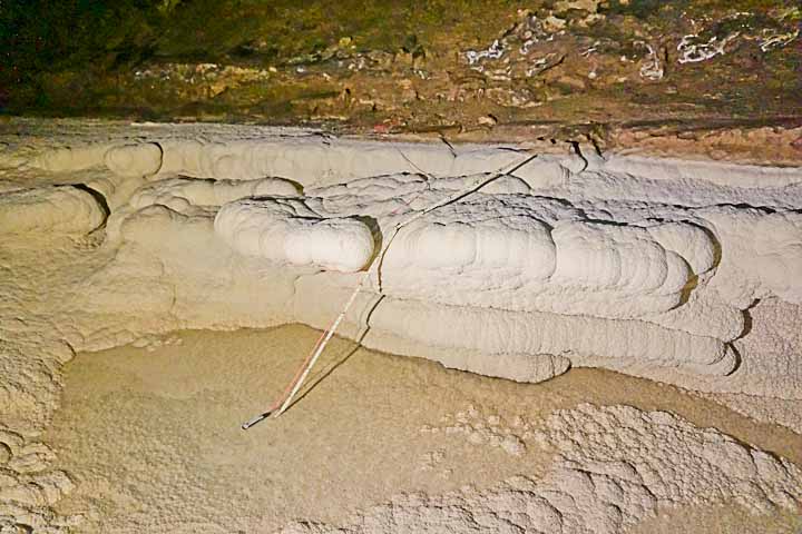
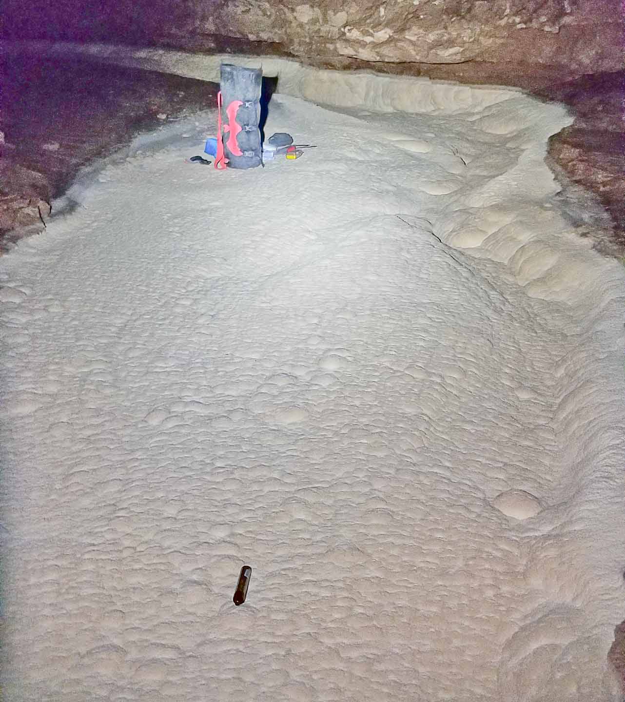
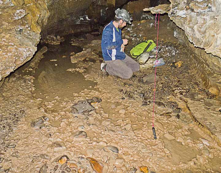
Uniform straight cross section for discharge inference downstream of Metro North crossing to see if water is added from the Metro fissure. This photo is currently the best floor photo, and shows the new EL-3 recoverable precision elevation survey station near SRN33. |
 |
Window Passage Snowy River, just downstream from the Priority 7 Landing SRN08 (Stage & temperature vs time from 2018) RT-100
|
Uniform straight cross section for discharge inference downstream from SRS10 and past the estimated location where water from Main Corridor and Sewer Pipe Passage might flow through breakdown into Snowy River. This location is near the path up to the upper Metro level. It is the downstream measurement point of the SRS10-SRN08 stretch which incorporates a wide stream "uniform" width with measured slope and cross section which will allow Manning Equation flow estimates. W25 logger installed 10-12-19 W17 logger installed 7-12-18 |
 |
P7 Discharge Site SRS10 site to be moved to SRS05 in 2022 (Stage & temperature vs time from 2018) RT=100 |
Uniform straight cross section for discharge inference between Turtle Junction & Priority 7 Landing. Provides value to compare with Turtle Junction measurement to see if discharge is gained or lost to sub-crust flow. Also for comparison with SRN08 for discharge gain from Main Corridor flow. The cross section and slope has been measured at this location. W12 logger installed 6-10-21 W23 logger installed 10-12-19 W11 logger installed 7-12-18 |
 |
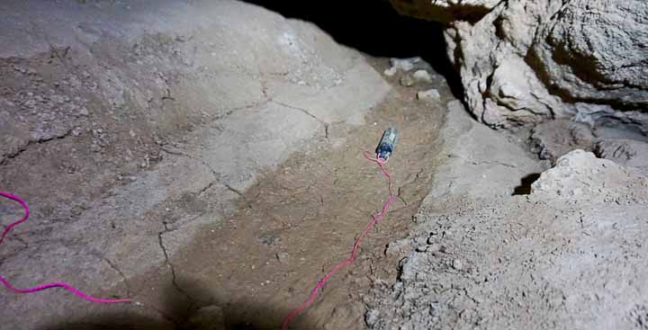
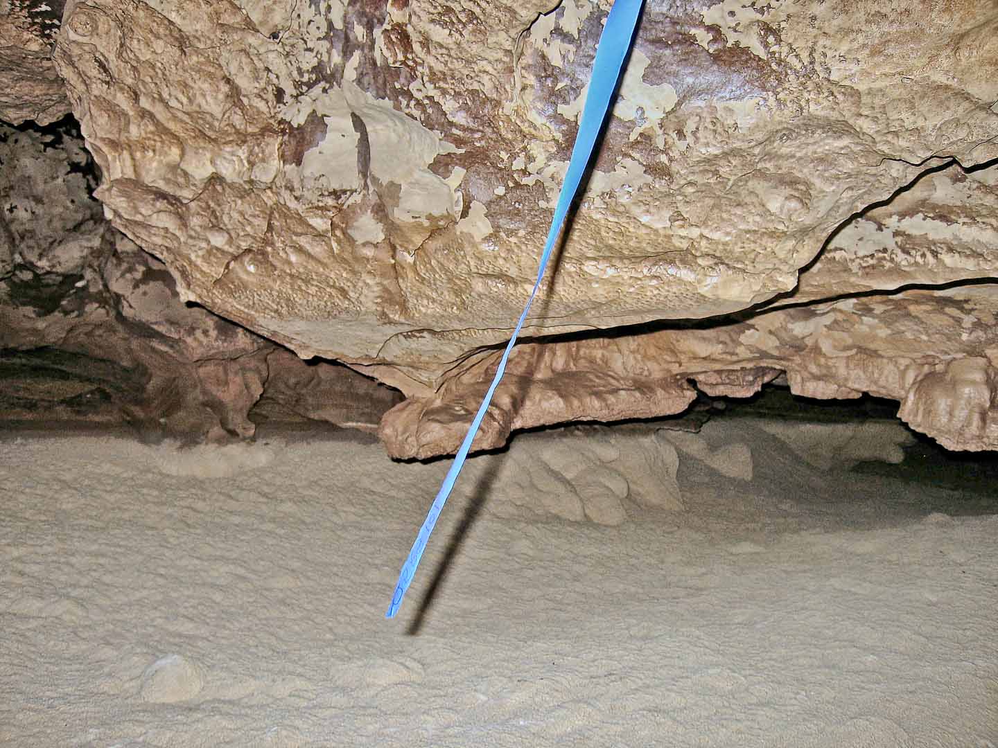
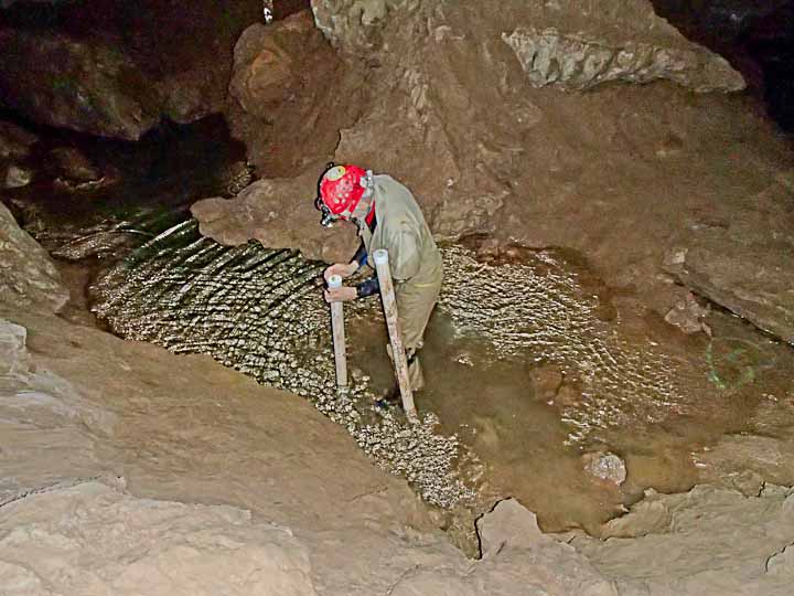
Just downstream from Turtle Junction, this typical Snowy River stretch has uniform widths with few rocks causing rapids. A core hole was drilled so that a Schlumberger Mini-Diver could be used to monitor water levels under the calcite floor. This site has the capability of measuring the drain-down characteristics of a "typical Snowy River surface" not immediately on top of a limestone base. The logger is a Schlumberger Mini-Diver (plus a Baro just downstream from the Mini-Diver) and was installed by the USGS in the core hole several inches below the top of the Snowy River Calcite surface. The logger was first installed under the calcite surface on 10-15-18 and additional details on that initial installation are in the Decade of Data Logging Report. Another installation at that site including "1 in the hole" and a 2nd logger just 2 feet upstream was done on 6-13-2021. |
|
|
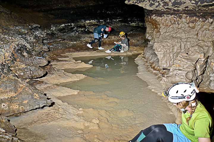
Turtle Junction SRS23 (Baro, stage & temperature vs time from 2009) (Baro, stage, temperature & conductivity vs. time 2013 to 2016) RT-Baros & RT-100s BLM Solinst Conductivity logger Other install dates: W13: 9-10-16 W16: 7-2-16 W12: 6-27-15 W3: 4-30-13 |
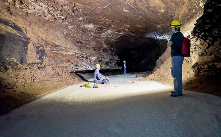
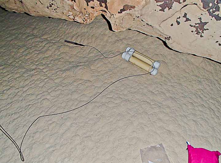
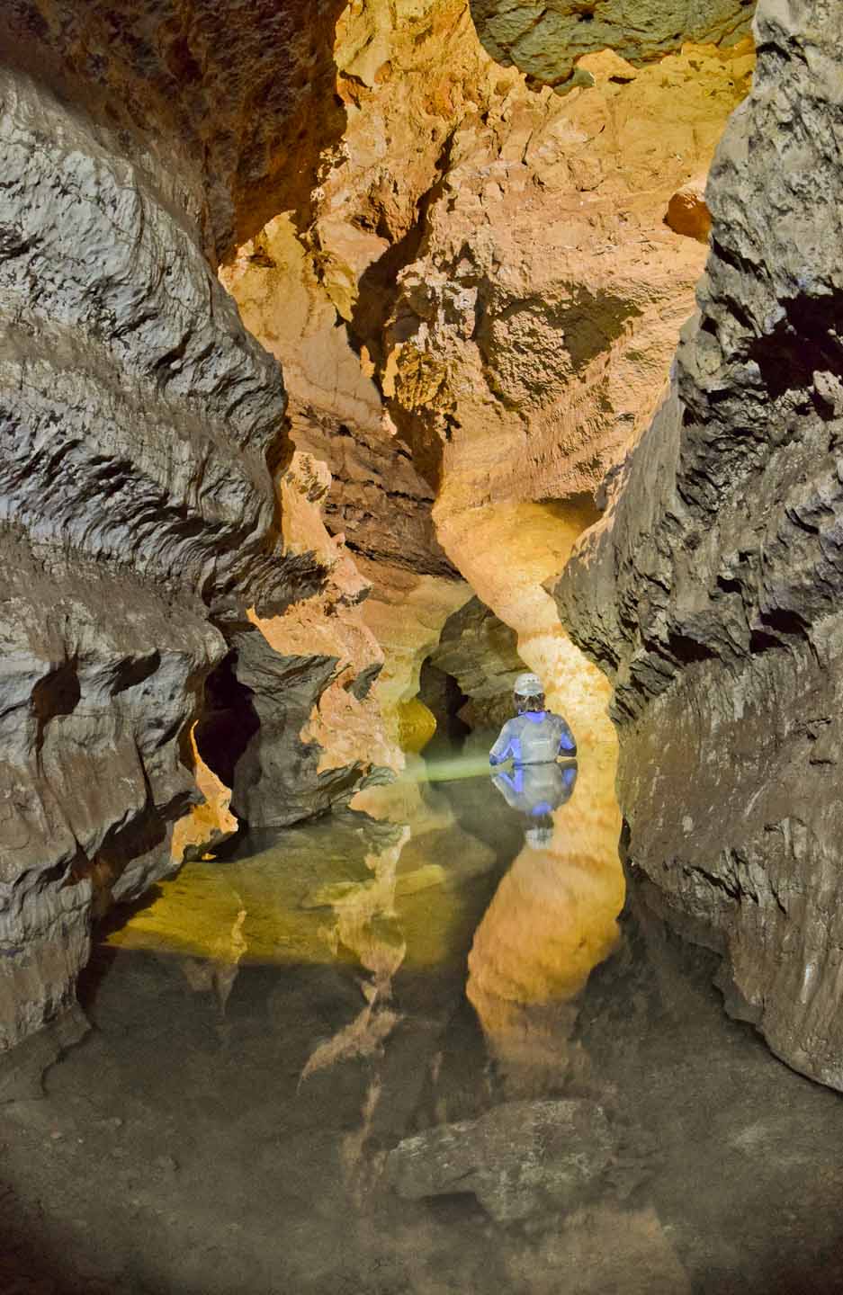
Turtle Junction is the main access point to Snowy River, and location available for Pygmy discharge measurements during flows. This is also the primary Baro reference location for compensation off the daily barometric pressure fluctuations for the logger stage measurements from Crystal Creek to Mt Airy, and beyond (for the 2013 deployment) (Turtle Junction flow photo 10-11-14 -->) The BLM had a Solinst conductivity logger installed here for several years. W8, B5 logger installed 10-12-19 W2 event logger 10-12-19 W16 logger installed 7-12-18 B4 installed 5-6-18 B3 & W12 installed The original Schlumberger Mini-Diver was the first commercial FSCSP logger at this location and recorded the 2010 flow. Also shown with the Mini-Diver are home-made loggers by Lindsley & McLean installed at Turtle Junction on 8-8-2008. (photo -->) |
|
Plunge Pool SRS31 (Stage & temperature vs time from 2013)\ RT-100 |
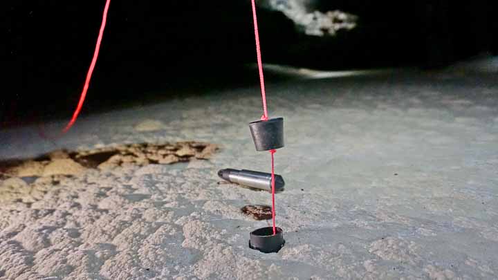
This 3-foot deep pool just upstream from TJ provides limited access during flow. Timing information between this pool and the primary logger site just downstream is part of the drain-down study. The nylon cord attached to the 3-foot deep loggers was retrieved for SEM analysis of calcite growth versus depth. W7 installed 10-12-19 W15 logger installed 5-6-18 W13 installed 9-10-16 W11 installed 10-24-15 W4 logger installed 4-30-13 |
 |
Independence Hall SRS53 (Stage & temperature vs time from 2009) |
Typical SR passage downstream from a breakdown blockage area. This site was the second BLM site just upstream from Turtle Junction. BLM Solinst logger installed 11-2-09 |
 |
Black Rock Bypass SRS107 (Baro, Stage & temperature vs time from 2020) RT-Baro & RT-100 |
This photo by John Lyles is at SRS101, six stations downstream from the SRS107 logger location. (A Roger Harris photo at SRS107 shows the lead, but not the Snowy River floor characteristic just before heading into the Crawl From Hell.) This site may be a temporary baro site set up in 2020 after the discovery of the Black Rock Bypass passage did not place the baro at SRS125, just upstream from the Crawl From Hell. At that time we had one extra water logger that was installed as well. Justification for this site will be reviewed after the 2020 logger installation in this area is analyzed. |
 |
Main Corridor |
Between Entrance & Turtle Junction |
|
Washtub Room (Also called HOTP) A-6 (Baro, stage & temperature vs time from 2015) RT-Baro & RT-100 |
This site is used for detection of a possible entrance area storm-water event, most likely detected by a temperature change. The Baro installed at this site is also used for calibration of other Main Corridor and Snowflake water loggers as well as local surface loggers. Water Logger & Baro reference location. B1 & W28 installed 5-5-19 B3 & W13 logger installed 10-15-18 W14 logger installed 10-24-15, following W17 & B1 + W3 W17 installed 9-10-16 |
|
20-Steps TH3 Pipe
(RT-100: Stage & temperature vs time from 2015) |
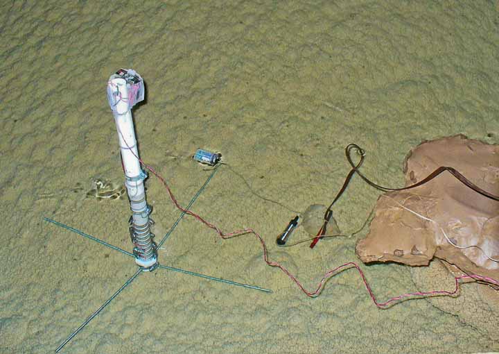
This 23-foot deep PVC pipe (installed 4-29-2009) in the floor to measure Main Corridor levels, is likely related to Rio Bonito insurgences and tied to the levels in Conrad's Branch as well as the sub-floor levels. It was once used as a temporary site for a baro logger that went to Turtle Junction. W3: 5-5-19, 9-10-16, 10-24-15 W- xx logger installed 10-15-18 W16 installed 4-22-17 W4 installed 7-2-16 W18 installed 7-24-15 (photo-->) |
 |
Sewer Pipe Landing SW-1, below DD-1 brass cap
(Stage & temperature vs time from 2015) RT-100 |
This site keeps a constant monitoring of the "deep water" which is backed up from the Fool's Crawl Sump. We are relating this water depth to other observed water depths just below Inscription Rock where most visitors wear wet suits during high water trips. The deepest monitored water level at Sewer Pipe Landing, when rafts were used to enter the cave, is when the Main Corridor and Conrad's Branch flooding is about 7 feet deep at the logger site. W6 logger installed 5-5-19 W xx logger installed 10-15-18 W12 installed 9-10--17 W15 installed 4-22-17 W15 installed 7-2-16 W13 installed 6-27-15 |
|
Snowflake Z9 (Stage & temperature vs time from 2019) RT-100 We hope to answer the question of a possible hydrological connection between SPL, Snowflake, and Turtle Junction using flow timing including water depths and temperature. |
Snowflake passage is normally entered from the Sewer Pipe Landing (SPL) area through Fool's Crawl ONLY when this far side of Conrad's Branch is not flooded with water. (A high level cut around, developed during the Priority 7 Dig, was used in July 2016 which found flooded passages which were obviously at the same elevation of the flooded passage at SPL.) Justification for this site is to learn more about the likely joining of this site, which is assumed to be fed by the Rio Bonito via Conrad's Branch, with the Snowy River Passage, which is assumed to be fed by Eagle Creek. Apparently this possible connection is a very tight, slow-flowing constriction that so far has no obvious joining with the adjacent Snowy River Passage. Recent precision elevation survey work between SPL and Turtle Junction has proven that their elevations are about the same, and possibly when Snowy River is flowing that elevation relates to the upper calcite "bathtub ring" elevation at SPL. |
 |
 |
||
Area #2 |
SR South Beyond Crawl from Hell |
|
Black Rock Bypass SRS107 (Baro, Stage & temperature vs time from 2020) RT-Baro & RT-100 |
This photo by John Lyles is at SRS101, six stations downstream from the SRS107 logger location. (A Roger Harris photo at SRS107 shows the lead, but not the Snowy River floor characteristic just before heading into the Crawl From Hell.) Unknown at the discovery time, this location had air from both SRN and BRB. The Baro change-out should be done with the water loggers at SRS125 and SRS141. This site had both a water and baro set up in 2020 after the discovery of the Black Rock Bypass passage. The water logger was removed in 2021 by error, but was placed back in 2022. Justification for this site will be reviewed after the 2023 logger installation in this area is analyzed. |
|
Snowy River Spring SRS125 (RT-100 & RT-Baro: Stage & temperature vs time from 2013) A baro logger at this site will allow more exact determination of sump levels at the bottom of the Two Way Hill breakdown blockage. |
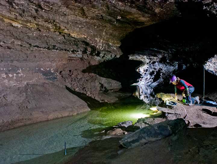
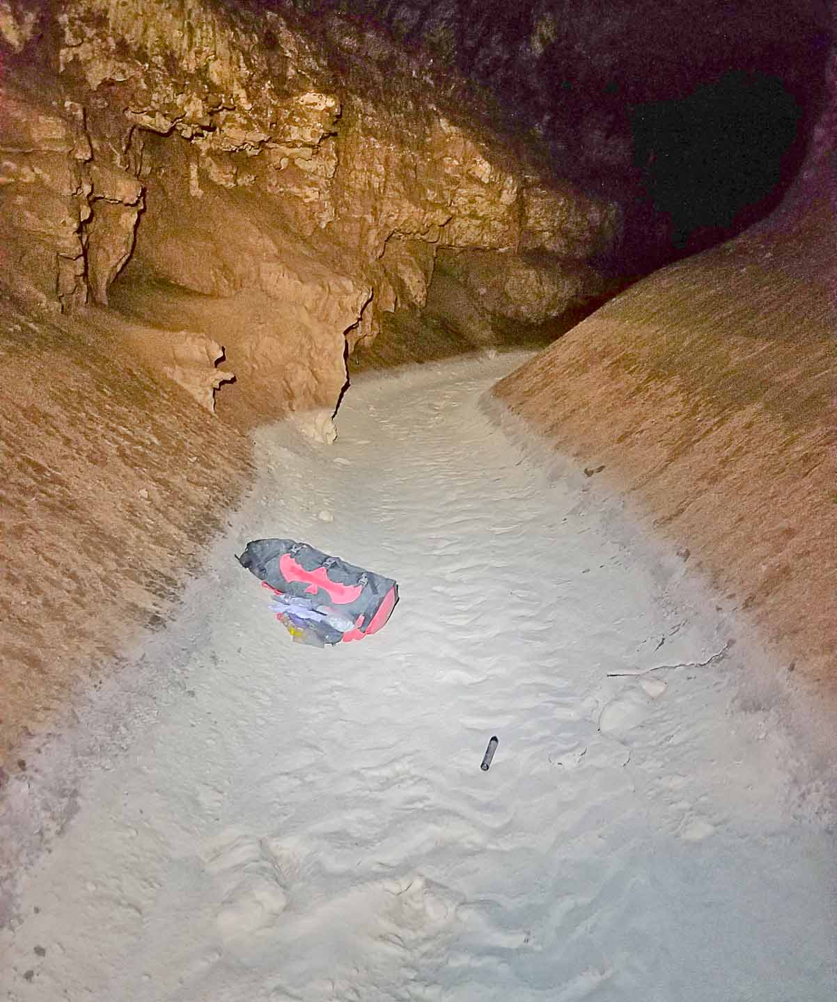
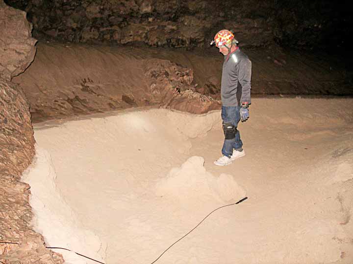
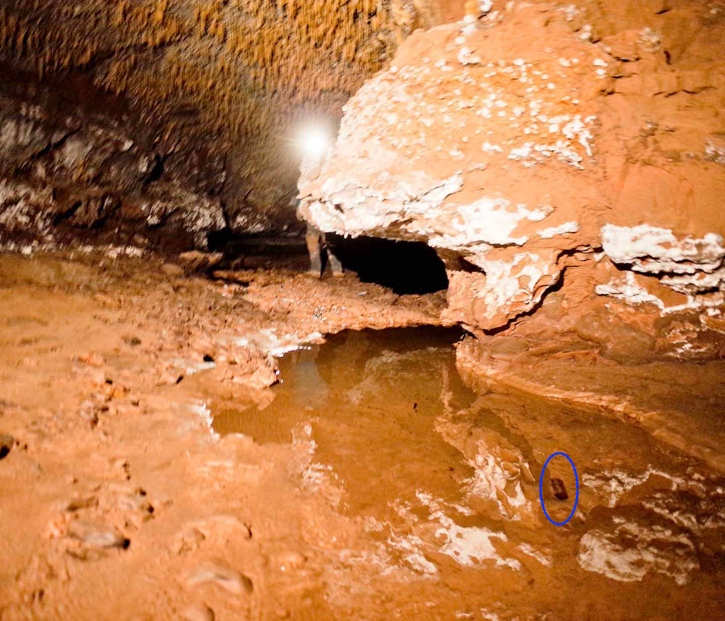
The original justification for these next three closely spaced loggers was to characterizes the assumed Mud Lizard sump passage. Data analysis is on-going measuring water depth and flow timing downstream from Bobbitt's Blvd, Mud Lizard and Snowy River Spring where at least some of the Snowy River flow rejoins the walking passage area north of the Two Way Hill breakdown W29 logger installed 10-4-19 W19 logger installed 9-8-18 W5 logger installed 5-3-13 (photo) |
 |
Mud Lizard SRS141 (Stage & temperature vs time from 2013) RT-100 |
The original logger placed at this location in 2013 was retrieved years later, and showed a 10-12 foot deep sump for a long period of time. (Recently the Black Rock Bypass was found to significantly minimize the danger of entrapment to deep Snowy River South teams during future flows.) Measure flow timing and water depth at the now known sump. W30 logger installed 10-4-19 W20 logger installed 9-8-18 W6 logger installed 5-3-13 (photo) |
 |
Bobbitt's Blvd. SRS171 (Stage & temperature vs time from 2013) RT-100 |
This site was positioned closely to Mud Lizard to provide timing and water depth data for a Snowy River flow suspected of filling the passage upstream from Return to Snowy River breakdown room. The newly discovered Black Rock Bypass re-joins Snowy River just upstream from this site. Based on recent analysis, it has been suggested that this site be moved 10 stations upstream to SRS181 (Underground Railroad) where the passage is more uniform. W31 logger installed 10-4-19 W21 logger installed 9-8-18 W7 logger installed 5-3-13 (photo) |
 |
SRS227 (From Station SRS227 the logger is located 23.9 ft., @ 279.6 Deg Az, and -12.1 Deg Inclination) (Stage & temperature vs time from 2019) RT-100
|
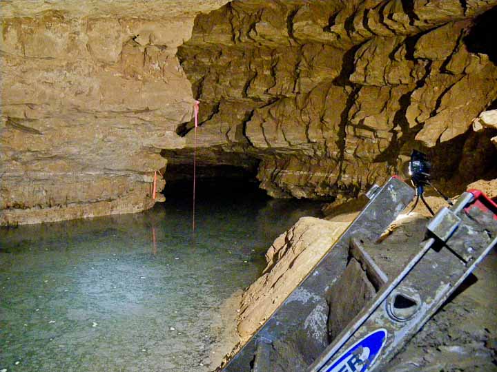
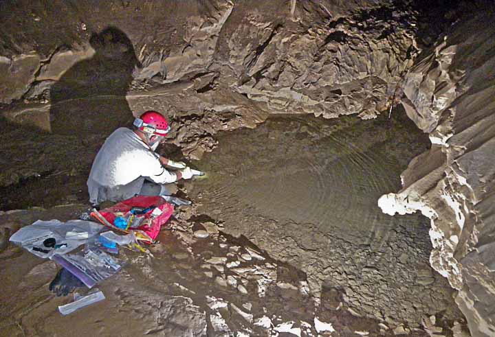
Discharge inference site to look for possible insurgence in Mt Airy breakdown zone. This site, along with SRS318, was added in October 2019 at a good location for future Manning equation flow measurements. A photogrammetry cross-section has been obtained, and a future "mini-Palmer Pole" measurement of the slope will be made on a future trip. W33 was placed here on 10-14-19 |
 |
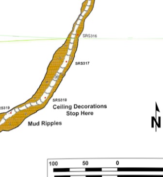
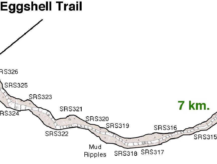
SRS318
(From Station SRS318 the logger is located 36.4 ft., @ 19.1 Deg Az, and -3.3 Deg Inclination) (Stage & temperature vs time from 2019) RT-100
|
Discharge inference site to look for possible insurgence in Mt Airy breakdown zone. This site, along with SRS227, was added in October 2019 at a good location for future Manning equation flow measurements. A photogrammetry cross-section has been obtained, but a future "mini-Palmer Pole" measurement of the slope will be made on a future trip. The location is just upstream of Mt. Airy W34 was placed on 10-14-19 |
 |
Floating Islands SRS374 (RT-100 & RT-Baro, stage & temperature vs time from 2011) 2020 analysis appears to show a sub-surface flow in the 2012 data. The baro here is accessible even when the MJ baro is not. |
This location was originally chosen in 2011 by a BLM team and a pair of Solinst loggers were deployed. It was assumed to be a good pool location downstream from possible side passages that might be an in-feeder under Elk Valley, just past the airport. A pair of In-Situ loggers were placed in this location in 2018. W32 & B4 loggers installed 10-4-19 W22 & B5 loggers installed 9-8-18 Solinst logger removed 9-8-18 Solinst logger installed 10-20-11 (photo) |
 |
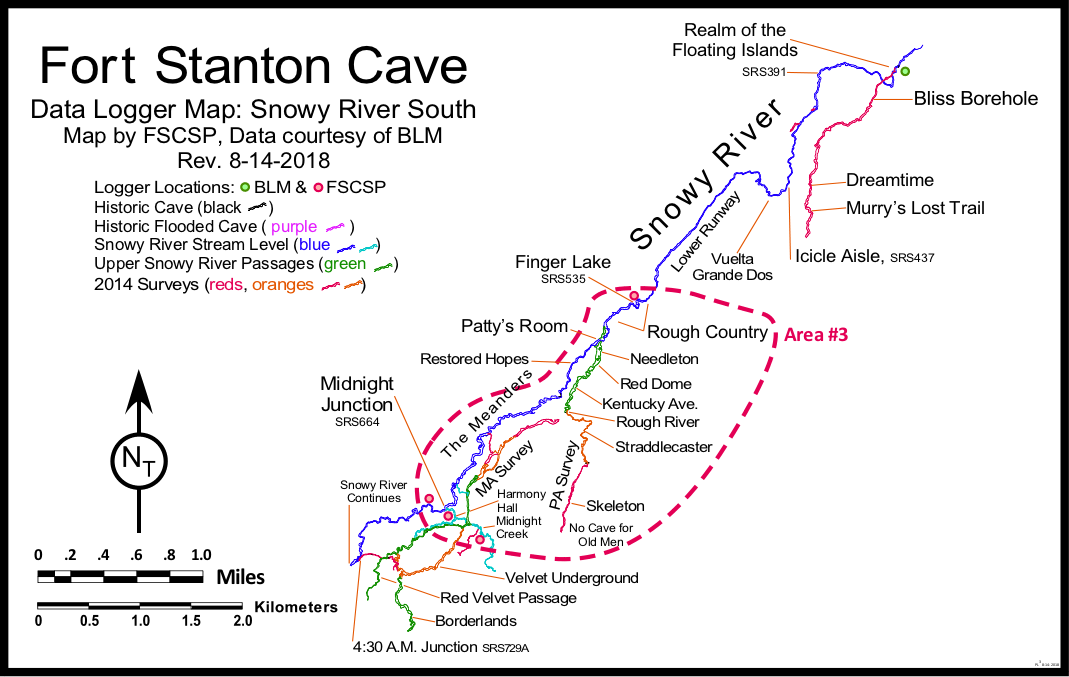
Area #3 |
Snowy River 6-10 miles from entrance |
|
 |
||
Finger Lake SRS535 (Stage & temperature vs time from 2013) RT-100 |
It was important to monitor this location just past the Rough Country breakdown as it is a good water source for deep cave trips including future camp trips to the Midnight Junction area. W21 logger installed 10-3-20 W8 logger removed 9-8-18 W8 logger installed 5-3-2013 (photo) |
 |
SRS656 (RT-Baro & temperature vs time from May 22, 2020) |
Ramon Armen This site was justified as being located just downstream from the Midnight Junction Camp. We think this spot in the main Snowy River flow channel will include the contribution of water from both upstream Snowy River at the 4:30 AM Junction as well as water from the Midnight Creek complex. The site is unique in this part of the cave because it is near one of the best potential data access portals on NCA Lands that would offer a reasonable access to a water well drilling rig approximately 630 feet above on a flat mesa area that could be easily considered for an environmental impact statement. In addition, the actual drill site would be fairly close to this logger location but in a cut-around side passage that would allow for drilling into the cave, but not directly over Snowy River, therefore properly protecting any drilling residue from reaching the Snowy River channel itself. The surface location was determined by use of a 3.5 kHz cave radio (at station SRS656B) at the same time as the initial logger installation. |
 |
Midnight Junction Baro SRS663 (RT-Baro & temperature vs time from 2013; New Baro forward from 7-1-2022) (This logger which only covered 2013-2014, has not yet been replaced due to high stream flows.) |
This is the primary campsite, 10 miles from entrance, for deep Snowy River South trips. There is only a baro logger at this location which will be used for calibration of the two water loggers in this remote area. B2 logger installed 5-3-2013 (photo) |
 |
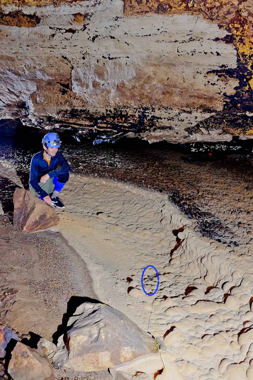
Snowy River Continues SRS667 (RT-100: Stage & temperature vs time from 2013-2014, & forward from 7-1-2022)
|
This location is the main continuation of Snowy River past Midnight Junction. 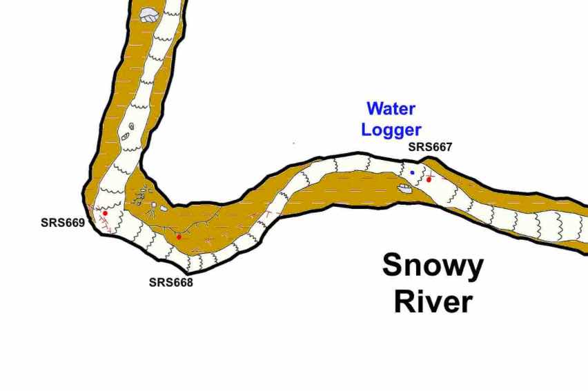 |
 |
MK1 (RT-100: Stage & temperature vs time from 7-1-2022) |
The W24 logger was deployed at this location during the cave radio trip on 5-21-22 due to lack of time after midnight during an attempted MK52 cave radio location. The team found evidence of recent water flows and deployed the logger at this location instead of exchanging the logger at the MJ27-28 Midnight Creek site. |
 |
MJ27-28 (RT-100 Stage & temperature vs time from 2013) (This logger which only covered 2013-2014, has not yet been replaced due to high stream flows.) |
Midnight Creek is the main side passage with water that we suspect drains into Snowy River at or downstream from Midnight Junction. This location offers possible indications of a Little Creek insurgence, and depending on the initial results from the 2013 installation, additional loggers may be deployed in this remote area. W9 logger installed 5-3-2013 (photo) |
 |
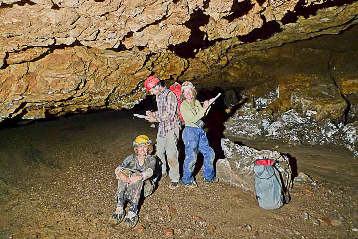
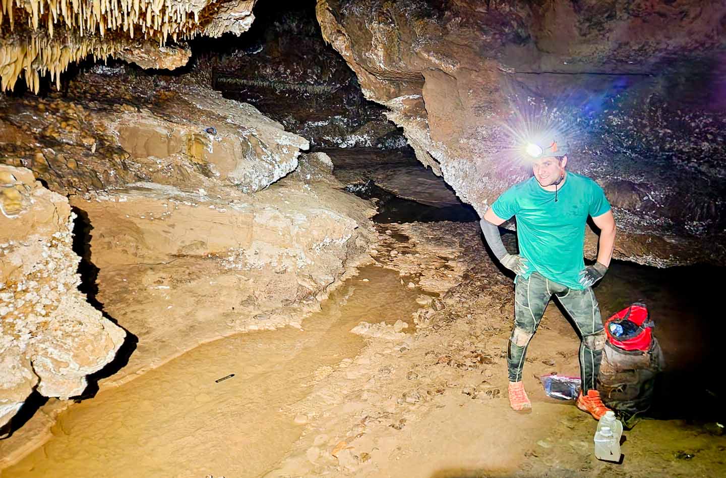
A Decade of Data Logging in Fort Stanton Cave and Snowy River This FSCSP report covers the majority of past data logging in Fort Stanton Cave and Snowy River. As one of longest stream passages in the world monitored by data loggers with only a single cave entrance, you can follow our team's efforts as we extend our knowledge of the local Hydrogeology. As we answer a few of the past questions, we are also finding new questions. |
||
Rev. 2-27-2023 |
Comments to the webmaster |
Contact the FSCSP President |
Contact the Project Director |